Other Services
Add-on CompetenceIn addition to our seismic vectorizing and trace tracking expertise, we offer several complementary digitization services.
Map Digitizing
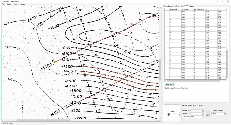
Should digital navigation data not already exist, it can be captured from base-map images. We use a leading map digitizing package which enables us to capture this information and convert between all common projection systems. Shot-points, wells, contours, boundaries and faults etc. can all be captured. Similarly, we can capture elevation information from seismic sections and load it into the vectorized SEG-Y trace headers.
Well Log Digitizing
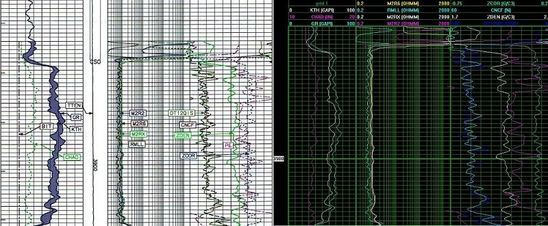
We can digitize the well log data from Standard Wireline Logs, Russian Style Format Logs, Mud Logs, Gas Logs and ‘Tadpoles’.
Logarithmic, hybrid, linear and reciprocal scales are all recorded.
Curves of a well are spliced and can be composited if required (including Depth Matching/Shift).
Additional well Log header metadata can be captured.
The digital data is delivered in LAS and LIS formats.
Post-Stack Processing
Our SEG-Y output is frequency filtered and amplitude balanced, and in most cases is ready for loading and interpretation. However, some stacked seismic sections recorded in areas with subsurface dipping reflectors often benefit from Migration. We use specialized software to correct for this, typically using a ‘Finite Difference’ migration algorithm.
Scanning & Image Digitizing
Increase the value of your paper and film documents by converting them to image files. Hard-copies of virtually any length can be scanned to a high resolution image file using wide format scanners.
UNRIVALLED SEISMIC VECTORIZING
EVALUATE A FREE TEST LINE TODAY
If you have any hard copy seismic sections or seismic images that you would like in SEG-Y format, we will gladly offer you a free test line to help highlight the impressive results that only we can achieve.